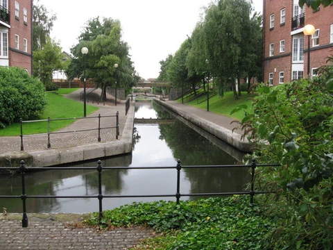
Manchester Ship Canal
Inland waterway linking Manchester to the Irish Sea.

via Wikipedia: Manchester Ship Canal · see source
The Manchester Ship Canal is a 36-mile-long (58 km) inland waterway in North West England that links Manchester to the Irish Sea. Beginning in the Mersey estuary at Eastham, near Ellesmere Port in Cheshire, it generally follows the original routes of the rivers Mersey and Irwell through the historic counties of Cheshire and Lancashire before terminating to the east of Salford Quays near Pomona Docks and a junction with the Bridgewater Canal where it meets the Irwell. Several sets of locks lift vessels about 60 ft (18 m) to the canal's terminus in Manchester. Landmarks along its route include the Barton Swing Aqueduct – the world's only swing aqueduct – and Trafford Park, the world's first planned industrial estate and one of the largest in Europe.
- length
- 36 miles (58 km)
- opened
- January 1894
- construction_start
- 1887
- construction_cost
- £15 million (equivalent to £1,705,000,000 in 2025)
- location
- North West England, from Eastham near Ellesmere Port to Manchester
- owner
- Peel Holdings (privately owned)
- peak_traffic
- 18 million long tons (20 million short tons) in 1958
Verified Timeline
Lore & Background
The rivers Mersey and Irwell were first made navigable in the early 18th century. Goods were also transported on the Runcorn extension of the Bridgewater Canal (from 1776) and the Liverpool and Manchester Railway (from 1830), but by the late 19th century the Mersey and Irwell Navigation had fallen into disrepair and was often unusable. Manchester's business community viewed the charges imposed by Liverpool's docks and the railway companies as excessive. A ship canal was proposed to give ocean-going vessels direct access to Manchester. The region was suffering from the Long Depression; the canal's proponents argued that the scheme would boost competition and create jobs. They gained public support for the scheme, which was first presented to Parliament as a bill in 1882. Faced with stiff opposition from Liverpool, the canal's supporters were unable to gain the necessary act of Parliament to allow the scheme to go ahead until 1885. Construction took six years, beginning in 1887, and cost just over £15 million (equivalent to £1,705,000,000 in 2025). When the ship canal opened in January 1894 (12 years after the first meeting of the Manchester Ship Canal company) it was the largest river navigation canal in the world and enabled the new Port of Manchester to become Britain's third-busiest port despite being about 40 mi (60 km) inland. The canal was completed just as the Long Depression was coming to an end, but in its early years it was not the commercial success its sponsors had hoped for. At first, gross revenue was less than a quarter of expected net revenue; and throughout at least its first nineteen years the canal was unable to make a profit or meet the interest payments to the Corporation of Manchester. Many ship owners were reluctant to dispatch ocean-going vessels along a 'locked cul-de-sac' at a maximum speed of 6 knots (11 km/h; 6.9 mph). The Ship Canal Company found it difficult to attract a diversified export trade; this meant that ships frequently had to return down the canal loaded with ballast rather than freight. However, traffic gradually developed and the Canal became successful, paying dividends from 1921 onwards.
Reader's Guide
The idea that the rivers Mersey and Irwell should be made navigable from the Mersey estuary in the west to Manchester in the east was first proposed in 1660 and revived in 1712 by the English civil engineer Thomas Steers. The necessary legislation was proposed in 1720, and the Act of Parliament for the navigation, the Rivers Mercy and Irwell Navigation Act 1720 (7 Geo. 1. St. 1. c. 15), passed into law in 1721. Construction began in 1724, undertaken by the Mersey and Irwell Navigation Company. By 1734 boats 'of moderate size' were able to make the journey from quays near Water Street in Manchester to the Irish Sea, but the navigation was only suitable for small ships; during periods of low rainfall or when strong easterly winds held back the tide in the estuary, there was not always sufficient depth of water for a fully laden boat. The completion in 1776 of the Runcorn extension of the Bridgewater Canal, followed in 1830 by the opening of the Liverpool and Manchester Railway, intensified competition for the carriage of goods. In 1825 an application had been made to Parliament for an Act to allow the construction of a ship canal between the mouth of the River Dee and Manchester at a cost of £1 million; however, 'the necessary forms not having been observed', it did not become law. In 1844 ownership of the Mersey and Irwell Navigation was transferred to the Bridgewater Trustees, and in 1872 it was sold to the Bridgewater Navigation Company for £1.112 million. The navigation had by then fallen into disrepair, its owners preferring instead to maintain the more profitable canal; in 1882 the navigation was described as being 'hopelessly choked with silt and filth', and was closed to all but the smaller boats for 264 out of 311 working days. The idea was championed by Manchester manufacturer Daniel Adamson, who arranged a meeting at his home, The Towers in Didsbury, on 27 June 1882. He invited the representatives of several Lancashire towns, local businessmen and politicians, and two civil engineers: Hamilton Fulton and Edward Leader Williams. Fulton's design was for a tidal canal, with no locks and a deepened channel into Manchester. With the city about 60 feet (18 m) above sea level, the docks and quays would have been well below the surrounding surface. Williams' plan was to dredge a channel between a set of retaining walls, and build a series of locks and sluices to lift incoming vessels up to Manchester. Both engineers were invited to submit their proposals, and Williams' plans were selected to form the basis of a Bill to be submitted to Parliament later that year. To generate support for the scheme, the provisional committee initiated a public campaign led by Joseph Lawrence, who had worked for the Hull and Barnsley Railway. His task was to set up committees in every ward in Manchester and throughout Lancashire, to raise subscriptions and sell the idea to the local public. The first meeting was held on 4 October in Manchester's Oxford Ward, followed by another on 17 October in the St. James Ward. Within a few weeks meetings had been held throughout Manchester and Salford, culminating in a conference on 3 November attended by the provisional committee and members of the various Ward Committees. A large meeting of the working classes, attended by several local notables including the general secretaries of several trade unions, was held on 13 November at the Free Trade Hall in Manchester. Regular night-time meetings were held across the region, headed by speakers from a range of professions. The weekly Ship Canal Gazette, priced at one penny, was by the end of the year being sold at newsagents in towns across Lancashire. One of the few surviving leaflets, 'The Manchester Ship Canal. Reasons why it Should be Made', argued against dock and railway rates, which were apparently levied 'with the object of protecting the interests of Railway kings, [so that] trade is handicapped, and wages kept low'. By the end of 1882 the provisional committee comprised members from several of Manchester's large industries, but notably few of the city's wealthier inhabitants. The sympathetic Manchester City News reported that 'the rich men of South and East Lancashire, with a few notable exceptions, have not rivalled the enthusiasm of the general public'.
Did You Know?
- The Barton Swing Aqueduct is the world's only swing aqueduct.
- When the canal opened in January 1894, it was the largest river navigation canal in the world.
- The canal enabled the Port of Manchester to become Britain's third-busiest port despite being about 40 miles (60 km) inland.
- Unlike most other British canals, the Manchester Ship Canal was never nationalised.
- The canal's speed limit for ocean-going vessels was 6 knots (11 km/h; 6.9 mph).
Frequently Asked Questions
What is the Manchester Ship Canal?
It is a 36-mile (58 km) inland waterway in North West England that runs from Eastham near Ellesmere Port all the way into Manchester, connecting the city directly to the Irish Sea.
Why was the Manchester Ship Canal built?
The canal was constructed so that ocean-going ships could reach Manchester without having to rely on Liverpool's docks or on rail transport, giving the city its own direct maritime link to the sea.
When was the Manchester Ship Canal built and how much did it cost?
Construction began in 1887 and the canal opened in January 1894 after roughly six years of work. The project cost around £15 million, which is equivalent to roughly £1.7 billion in 2025 money.
Who owns the Manchester Ship Canal today?
The waterway is privately owned by Peel Holdings, a major UK property and infrastructure group that manages it as part of its broader portfolio of real-estate and canal assets.
How does the Manchester Ship Canal's story end in the modern era?
While it no longer carries the heavy industrial freight traffic of the Victorian and Edwardian periods, the canal survives as a navigable waterway used for leisure boating, tourism, and limited commercial traffic, still linking Manchester to the Irish Sea.
More in Canals And Waterways 1-24
Elsewhere in the Canals And Waterways universe
Spotted an error? Know more?
This is a living reference — every entry is fact-audited, and reader corrections feed straight into our audit queue. Suggest an edit · See this site's audit record