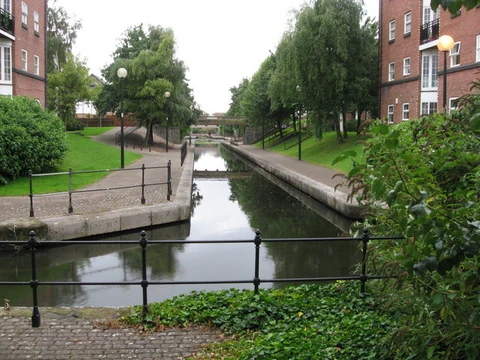
Leidsevaart

The Leidsevaart, also known as the Leidse trekvaart, is a canal between the cities of Haarlem and Leiden in the Netherlands.
- type
- Canal
- location
- Netherlands, between Haarlem and Leiden
- length
- Not specified in article
- primary use
- Transport by trekschuit and barge
Lore & Background
Travel on the canal was done by trekschuit for people and by barge for goods, pulled by animals or sometimes by manpower along a towpath. The service was reliable, comfortable, and cheap, with a speed of about 7 kilometers per hour—faster than walking and more comfortable than traveling by coach. Many wealthy Amsterdam families had summer homes along the Leidsevaart or the Spaarne River, and they arrived with heavy belongings by barge, often pulled or sailed directly to their door via canal spurs dug for that purpose.
Reader's Guide
The Leidsevaart was maintained through toll money and taxes. Estate owners who dug canal spurs to their doorsteps paid taxes for fishing rights, swan-keeping rights, or general canal use. Landowners whose land was taken for the canal were compensated for the land strip but had to pay for a bridge themselves. Trekschuit owners also paid taxes, with heavier taxes on passenger traffic than on goods. Today, many drawbridges along its course are no longer in operation, making the Leidsevaart unsuitable for boat traffic and largely disused. The original stops along the railway mirrored the toll bridges of the canal. Several notable estates lie along its route, including Oud Poelgeest, Keukenhof, and the Hartekamp.
Did You Know?
- Travel speed on the canal was about 7 kilometers per hour, faster than walking.
- Many wealthy Amsterdam families had summer homes along the Leidsevaart with private canal spurs.
A Straight Line Across the Bay
Before the seventeenth century, anyone traveling between Amsterdam and Haarlem by water had no choice but to navigate the IJ, a broad bay of the Zuiderzee. The overland alternative was equally unappealing: a winding dike path that traced the bay's irregular shoreline. Coaches departing Haarlem would follow the Oude Weg northward to the Liede, cross by a penny ferry at Penningsveer to Spaarnwoude, and then labor along the IJdijk all the way to Amsterdam. Boats fared no better, forced to climb the Spaarne river and squeeze through a narrow sluice at Spaarndam before reaching open water. The new waterway slashed the distance for both boats and land traffic, and because it was the first of its kind in the region, it earned the distinction of being Holland's oldest tow-canal. The towpath running alongside it gave animals—and occasionally human teams—a dedicated route for pulling barges, replacing the old dike road with something far more direct.
Towed Barges and a Town Born at the Midpoint
The system was elegant in its simplicity: a barge on the water, a team of beasts on the path beside it. Yet the canal was not one unbroken stretch. A sluice gate separating Haarlem Lake from the IJ broke the route in two, forcing every passenger to disembark at the midpoint and transfer to a waiting vessel. That halfway stop grew into the small town of Halfweg, its very name a reminder of the journey's division. Commercial cargo was explicitly barred from the canal, reserving it for people rather than goods. A layered and intricate tax regime governing water transport further protected the trekschuit operators from competition, and this combination of restricted access and fiscal regulation allowed the barge service to remain a dependable form of passenger travel for several centuries. The towpath itself, once a working corridor for draft animals and the occasional human team, became the defining feature of the route.
The Leap to Leiden
The proven success of the Haarlem-to-Amsterdam route inspired a bold extension of the canal network. This expansion was a direct consequence of the Haarlemmertrekvaart's track record: decades of reliable trekschuit service, protected by its tax framework and passenger-only restrictions, had demonstrated that a straight, towed canal could outperform the older, circuitous routes around the IJ bay. The Leidsevaart thus became the natural next chapter in a regional pattern of waterborne connectivity. Together, the two canals formed a corridor linking Amsterdam, Haarlem, and Leiden, and the principle of a dedicated tow-canal—straight, controlled, and reserved for passengers rather than commercial freight—had been validated by over twenty-five years of operation on the original stretch.
Railway, Polder, and Pump: The Canal's Later Chapters
Trains offered speed and convenience that no animal-towed barge could match, and the centuries-old system of passengers disembarking at Halfweg to change vessels quietly faded into obsolescence. The old sluice gate that had once broken the canal into two sections was repurposed as a steam-driven drainage pump, a mechanical echo of the water management that had made the canal possible in the first place. That pump survives today as a museum, a tangible link to the engineering heritage of the route. While no commercial or passenger shipping remains on the waterway, the canal continues to serve a vital function in modern water management, quietly performing the same hydraulic work that its builders intended four centuries ago.
Frequently Asked Questions
What is the Leidsevaart?
The Leidsevaart, sometimes called the Leidse trekvaart, is a canal running between the Dutch cities of Haarlem and Leiden.
What was the Leidsevaart's main function?
For nearly two centuries it carried trekschuiten and barges, serving as the principal transport artery linking Haarlem and Leiden.
More in Canals And Waterways 25-36
Elsewhere in the Canals And Waterways universe
Spotted an error? Know more?
This is a living reference — every entry is fact-audited, and reader corrections feed straight into our audit queue. Suggest an edit · See this site's audit record