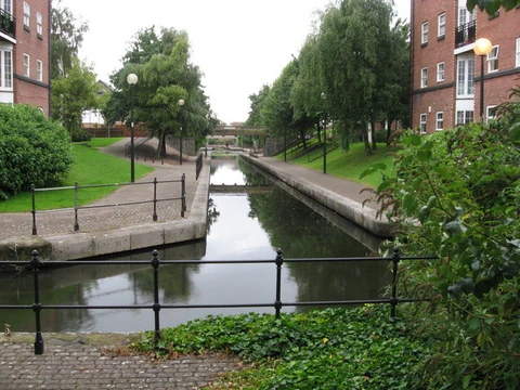
Intracoastal Waterway
Inland waterway along U.S. Atlantic and Gulf coasts.

via Wikipedia: Intracoastal Waterway · see source
The Intracoastal Waterway (ICW) is a 3,000-mile (4,800 km) inland waterway along the Atlantic and Gulf of Mexico coasts of the United States, running from Massachusetts southward along the Atlantic Seaboard and around the southern tip of Florida, then following the Gulf Coast to Brownsville, Texas. Some sections consist of natural inlets, saltwater rivers, bays, and sounds, while others are artificial canals. Maintained, improved, and extensively dredged where necessary by the United States Army Corps of Engineers, it provides a navigable route along its length without many of the hazards of travel on the open sea.
- length
- 3,000 miles (4,800 km)
- location
- Atlantic and Gulf coasts of the United States
- terminus_north
- Massachusetts
- terminus_south
- Brownsville, Texas
- maintained_by
- United States Army Corps of Engineers
- first_federal_report
- 1808
- key_legislation
- Rivers and Harbors Act of 1909
Verified Timeline
Lore & Background
The ICW's early history traces to an 1808 report by Treasury Secretary Albert Gallatin, who proposed canals connecting natural waterways from Massachusetts to Georgia, estimating the cost at about three million dollars. Gallatin wrote that a sea vessel entering the first canal in Boston harbor could reach Brunswick on the Raritan, then pass through a second canal to Trenton on the Delaware, a third to Elk River and the Chesapeake, and a fourth into Albemarle Sound, continuing to Beaufort and Swansboro in North Carolina. His full $20 million, 10-year plan was never approved, but after the War of 1812 and the British blockade highlighted the need, many of his proposals were built starting with the 1824 General Survey Act and subsequent rivers and harbors legislation. The Delaware and Raritan Canal was later abandoned, but the Cape Cod Canal remains in operation, and the Delaware and Dismal Swamp portions still form part of the larger present-day ICW. In 1826, Congress authorized the first survey for an inland canal between the Atlantic Ocean and Gulf of Mexico. The Rivers and Harbors Act of 1909 set national policy for an intracoastal waterway from Boston to the Rio Grande, and the River and Harbor Act of 1927 authorized the Atlantic Intracoastal Waterway using a route planned by the Jacksonville District of the Corps of Engineers. During World War II, after German submarines sank numerous merchant ships off the East Coast, the need for efficient transportation of bulk materials was demonstrated. By 1942, the 9 ft × 100 ft ICW channel was completed between New Orleans and Corpus Christi.
Reader's Guide
The ICW is significant as a protected inland navigation route that reduces the hazards of open-sea travel. Its development reflects over two centuries of federal investment, beginning with Albert Gallatin's 1808 report and continuing through the 1824 General Survey Act and numerous rivers and harbors acts. The waterway's construction involved both natural waterways and artificial canals, with the United States Army Corps of Engineers responsible for maintenance and dredging. The ICW's role in national defense was highlighted during the War of 1812 and World War II, when German submarine attacks demonstrated the need for protected inland routes. It also contributed to competition among transportation modes, as Congress promoted waterways to counter railroad monopolies. The waterway forms the eastern end of the Great Loop, which allows waterborne circumnavigation of the eastern continental United States using minimal ocean travel. Today, federal law provides for the waterway to be maintained at a minimum depth of 12 feet for most of its length, but inadequate funding has prevented that; larger ships encounter shoaling or shallow waters with 7-foot or 9-foot minimum depths from earlier improvements. No tolls are charged, but commercial users have been charged a fuel tax since 1978, originally set at 4 cents per gallon in 1980 and gradually raised to 10 cents per gallon by 1986, with funds held in the Inland Waterways Trust Fund to cover half the cost of new construction and major rehabilitation.
Did You Know?
- The ICW runs from Massachusetts southward along the Atlantic Seaboard and around the southern tip of Florida, then following the Gulf Coast to Brownsville, Texas.
- Treasury Secretary Albert Gallatin's 1808 report proposed canals to connect natural waterways from Massachusetts to Georgia, estimating the cost at about three million dollars.
- The Rivers and Harbors Act of 1909 set national policy for an intracoastal waterway from Boston to the Rio Grande.
- During World War II, German submarines sank numerous merchant ships off the East Coast, demonstrating the need for the ICW's protected inland route.
- Commercial users have been charged a fuel tax since 1978, originally 4 cents per gallon in 1980, raised to 10 cents per gallon by 1986, with funds held in the Inland Waterways Trust Fund.
Frequently Asked Questions
What is the Intracoastal Waterway?
The Intracoastal Waterway is a long inland navigation channel that hugs the U.S. Atlantic and Gulf coasts, giving vessels a protected alternative to open-ocean travel. It stretches from Massachusetts down through Florida and along the Gulf Coast to Brownsville, Texas.
How long is the Intracoastal Waterway?
The ICW spans roughly 3,000 miles (about 4,800 km) of navigable water. That makes it one of the longest continuous coastal waterways in the world.
Where does the Intracoastal Waterway begin and end?
Its northern terminus is in Massachusetts, and it runs southward along the Atlantic Seaboard, loops around the tip of Florida, then heads west along the Gulf Coast to Brownsville, Texas.
Who is responsible for maintaining the Intracoastal Waterway?
The United States Army Corps of Engineers serves as the federal agency charged with upkeep and improvement of the waterway's channels and structures. Their ongoing work keeps the route passable for both commercial and recreational traffic.
Why is the Intracoastal Waterway important to mariners?
It provides a sheltered, inland route that avoids the hazards of open-sea travel for thousands of miles. The idea was first formally examined in a federal report as early as 1808, and the waterway remains a vital artery for commerce and recreation today.
More in Canals And Waterways 1-24
Elsewhere in the Canals And Waterways universe
Spotted an error? Know more?
This is a living reference — every entry is fact-audited, and reader corrections feed straight into our audit queue. Suggest an edit · See this site's audit record