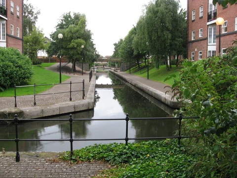
Welland Canal
Ship canal in Ontario, part of the St. Lawrence Seaway.
The Welland Canal is a ship canal in Ontario, Canada, that forms part of the St. Lawrence Seaway and Great Lakes Waterway. It crosses the Niagara Peninsula, connecting Port Weller on Lake Ontario to Port Colborne on Lake Erie. The canal was necessary because the Niagara River, the only natural link between the two lakes, is blocked by Niagara Falls. It allows vessels to climb or descend the Niagara Escarpment, and over time it has taken four different paths.
Roughly 3,000 ships use the canal each year, carrying about 40 million tonnes (88 billion pounds) of cargo. The canal played a major role in Toronto’s growth. It enabled goods from Great Lakes ports like Cleveland, Detroit, Milwaukee, and Chicago, along with other industrial areas in the United States and Ontario, to reach Montreal or Quebec City, where they were typically transferred to ocean-going ships for international trade.
The canal first opened on November 30, 1829, and has been rebuilt many times to handle larger vessels and speed up travel. The First Welland Canal was dug from 1824 to 1829 and operated until 1845. The Second Welland Canal, built between 1841 and 1845, used stone locks instead of wood and was wider and deeper; it stayed in use for nearly a century before closing in 1935. The Third Welland Canal, constructed from 1872 to 1877, was even deeper and wider, cut a straighter route through the escarpment, and had 26 masonry locks lined with wood to protect ships; it operated alongside the second canal and also closed in 1935. The Fourth Welland Canal, still in use, began construction in 1913 but was delayed by World War I and finished in 1932. It is deeper and wider than the third, with an opening that allows two large ships to pass in opposite directions, and it reduced the number of locks to eight, compared to the first canal’s 40.
The Welland Canal surpassed narrower regional canals, like the Trent-Severn Waterway and the Erie Canal (which connected the Atlantic to Lake Erie via New York City and Buffalo), by offering a shorter, more direct route from Port Colborne on Lake Erie to Port Weller on Lake Ontario.
The southern end of the canal on Lake Erie sits 99.5 metres (326 feet) higher than the northern end on Lake Ontario. The canal has eight ship locks, each 24.4 metres (80 feet) wide. Seven of these (Locks 1–7, the “Lift” locks) are 233.5 metres (766 feet) long and raise or lower ships by 13 to 15 metres (43 to 49 feet) each. The southernmost lock (Lock 8, the “Guard” or “Control” lock) is 349.9 metres (1,148 feet) long.
The Garden City Skyway crosses over the canal, limiting the height of ship masts to 35.5 metres (116 feet). All other highway or railroad crossings are either movable bridges (vertical lift or bascule types) or tunnels. The maximum ship length allowed is 225.5 metres (740 feet). It takes about eleven hours on average for a ship to travel through the canal.
**History**
Before the canal was built, shipping between Lake Ontario and Lake Erie relied on a portage road between Chippawa, Ontario, and Queenston, Ontario, both on the Niagara River—above and below the falls.
**First Welland Canal**
The Welland Canal Company was incorporated by the Province of Upper Canada in 1824, following a petition from nine “freeholders of the District of Niagara.” One petitioner was William Hamilton Merritt, who partly wanted a steady water supply for his water-powered industries along Twelve Mile Creek in Thorold. Construction began at Allanburg, Ontario, on November 30, at a spot now marked on the west end of Bridge No. 11 (formerly Highway 20). The canal opened for a trial run on November 30, 1829. After a brief ceremony at Lock One in Port Dalhousie, the schooner *Anne & Jane* (also called *Annie & Jane* in some texts) made the first trip, heading upbound to Buffalo, New York, with Merritt on deck.
The first canal ran from Port Dalhousie on Lake Ontario south along Twelve Mile Creek to St. Catharines. From there it wound up the Niagara Escarpment through Merritton to Thorold, then continued south via Allanburg to Port Robinson on the Welland River. Ships then went east (downstream) on the Welland River to Chippawa, at the south (upper) end of the old portage road, where they turned sharply right into the Niagara River to head upstream toward Lake Erie. Originally, the section between Allanburg and Port Robinson was planned as a tunnel, but the sandy soil made that impossible, so a deep open-cut canal was dug instead.
A southern extension from Port Robinson opened in 1833, with the founding of Port Colborne. This extension followed the Welland River south to Welland (then called the settlement of Aqueduct, after the wooden aqueduct that carried the canal over the river there), then split to run south to Port Colborne on Lake Erie. A feeder canal ran southwest from Welland to another point on Lake Erie, just west of Rock Point Provincial Park in Port Maitland. With this extension, the canal stretched 44 km (27 miles) between the two lakes, using 40 wooden locks. The smallest lock was 33.5 by 6.7 metres (110 by 22 feet), and the minimum canal depth was 2.4 metres (7.9 feet). Deterioration of the wooden locks and the growing size of ships soon led to demand for the Second Welland Canal, which used cut stone locks.
- opened
- November 30, 1829
- length
- 44 km (27 mi) at first extension
- number_of_locks_current
- 8
- elevation_difference
- 99.5 metres (326 feet)
- annual_cargo
- about 40 million tonnes (88 billion pounds)
- annual_ship_traffic
- about 3,000 ships
- average_transit_time
- about eleven hours
Lore & Background
The Welland Canal was built to bypass the unnavigable Niagara River, which is blocked by Niagara Falls. The first canal was excavated between 1824 and 1829, opening on November 30, 1829, with 40 wooden locks. It ran from Port Dalhousie on Lake Ontario south along Twelve Mile Creek, then up the Niagara Escarpment through Merritton and Thorold to Port Robinson on the Welland River, and then to Chippawa on the Niagara River. A southern extension to Port Colborne on Lake Erie opened in 1833. The Second Welland Canal, built between 1841 and 1845, used stone locks and had greater width and depth; it operated until 1935. The Third Welland Canal, built between 1872 and 1877, was deeper and wider still, with 26 masonry locks, and also closed in 1935. The Fourth Welland Canal, which remains in operation, began construction in 1913 and was completed in 1932, with eight locks and a depth of 7.6 m (25 ft). The canal passes about 3,000 ships transporting about 40 million tonnes of cargo a year, and was a major factor in the growth of Toronto.
Reader's Guide
The Welland Canal was a major factor in the growth of the city of Toronto, Ontario. It allowed goods from Great Lakes ports such as Cleveland, Detroit, Milwaukee, and Chicago, as well as other heavily industrialized areas of the United States and Ontario, to be shipped to the Port of Montreal or to Quebec City, where they were usually reloaded onto ocean-going vessels for international shipping. The canal eclipsed other, narrower canals in the region, such as the Trent-Severn Waterway and the Erie Canal, by providing a shorter, more direct connection from Port Colborne on Lake Erie to Port Weller on Lake Ontario. Its successive reconstructions accommodated larger vessels and quicker navigation, reducing the number of locks from 40 in the first canal to eight in the current one. The canal's southern terminus on Lake Erie is 99.5 metres higher than its northern terminus on Lake Ontario, and it takes an average of about eleven hours for a ship to traverse the canal.
Did You Know?
- The first canal had 40 wooden locks, while the current canal has only 8 locks.
- The southern terminus on Lake Erie is 99.5 metres (326 feet) higher than the northern terminus on Lake Ontario.
- The Garden City Skyway limits ship mast height to 35.5 m (116 ft).
- The maximum permissible length of a ship in the canal is 225.5 metres (740 feet).
- The Welland Canal's first 'hands-free' vacuum mooring was tested in Lock 7 prior to 2014.
Frequently Asked Questions
What is the Welland Canal?
It is a ship canal in Ontario, Canada, linking Port Weller on Lake Ontario to Port Colborne on Lake Erie. It operates as part of the St. Lawrence Seaway and the broader Great Lakes Waterway.
Why was the Welland Canal built?
The Niagara River, the sole natural connection between the two lakes, was impassable because of Niagara Falls. The canal was constructed so that vessels could bypass the falls and cross the Niagara Escarpment safely.
How many locks does the Welland Canal have today?
The current route contains eight locks that together manage a total elevation change of roughly 99.5 metres (326 feet) between the lake levels.
How much cargo and ship traffic does the Welland Canal handle each year?
Approximately 3,000 vessels transit the canal annually, moving around 40 million tonnes (88 billion pounds) of cargo.
When did the Welland Canal first open, and has its route changed since?
The original canal opened on November 30, 1829. Since then the waterway has been rebuilt and rerouted four times, with the present alignment measuring about 44 km (27 mi) at its first extension.
More in Canals And Waterways 1-24
Spotted an error? Know more?
This is a living reference — every entry is fact-audited, and reader corrections feed straight into our audit queue. Suggest an edit · See this site's audit record