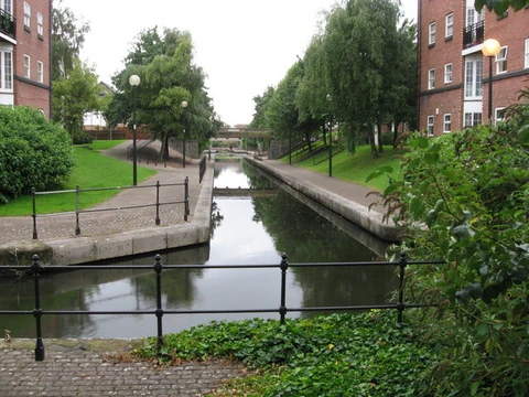
Stecknitz Canal
First European summit-level canal, linking North and Baltic Seas.
The Stecknitz Canal, known in German as the Stecknitzfahrt, was a man-made waterway in northern Germany. It connected the towns of Lauenburg and Lübeck along the Old Salt Route by joining two small rivers: the Stecknitz, which flows into the Trave, and the Delvenau, which flows into the Elbe. This created an inland route that crossed the watershed between the North Sea and the Baltic Sea. Construction took place from 1391 to 1398, making it Europe’s first summit-level canal and one of the continent’s earliest artificial waterways. During the 1890s, a larger, straighter channel called the Elbe–Lübeck Canal replaced it, though parts of the original Stecknitz Canal’s path were reused. The original canal was 0.85 meters (33 inches) deep and 7.5 meters (25 feet) wide. The man-made section stretched 11.5 kilometers (7.1 miles), but including the rivers it linked, the total length reached 97 kilometers (60 miles). Seventeen wooden locks managed the 13-meter (43-foot) elevation difference between the endpoints and the highest central section, the Delvenaugraben. One of these locks, the Palmschleuse in Lauenburg, still exists today. In the Middle Ages, trade between the North Sea and Baltic Sea expanded rapidly, but the sea route through the Øresund, which had become vital for commerce since the 13th century, was slow and risky. As a result, the Hanseatic city of Lübeck and Eric IV of Saxe-Lauenburg agreed in 1390 to build a canal between the Elbe and the Baltic. Work began in 1391, and on 22 July 1398, thirty barges carrying Lüneburg salt reached Lübeck for the first time. The canal soon replaced the overland cart road as the main way to transport Lüneburg salt along the Old Salt Route. In Lübeck, the salt was stored in large warehouses before being loaded onto ocean ships for export across the Baltic region. In the opposite direction, Stecknitz barges carried cereals, furs, herring, ash, timber, and other goods from Lübeck. These were unloaded in Lauenburg and sent down the Elbe to Hamburg. Later, coal, peat, brick, limestone, and gravel were also transported. The canal was especially important in years when the Øresund was closed to merchant ships due to disputes over Sound Dues and foreign shipping. Traffic peaked in the 15th century, with over 3,000 shipments moving more than 30,000 tons of salt each year. By the 17th century, this had dropped to between 400 and 600 shipments (5,000 to 7,000 tons). In 1789, only 64 shipments carried about 680 tons of salt. Plans for a new Baltic–North Sea canal had been proposed as early as the 17th century, but none were carried out until the late 19th century, when the Elbe–Lübeck Canal was built using parts of the old route. For 500 years, the Stecknitz Canal was used to move “white gold” and other goods. Today, the Palmschleuse lock in Lauenburg is one of the few remaining parts of the old canal, preserved as a historical monument. The canal consisted of an 11.5-kilometer artificial trench called the Delvenaugraben, which connected the north-flowing Stecknitz and the south-flowing Delvenau. The trench itself was about 85 centimeters deep and 7.5 meters wide, though it was enlarged between 1821 and 1823 to a depth of 144 centimeters (57 inches) and a width of 12 meters (39 feet). Outside the man-made section, the canal followed the winding natural courses of the two rivers, making the full trip from Lauenburg to Lübeck 97 kilometers long, even though the straight-line distance between the cities is only 55 kilometers (34 miles). The journey often took two weeks or more because of the many locks and the difficulty of towing. The canal originally had 13 locks, which later renovations increased to 17. Most were initially one-gate flash locks built into weirs, usually placed below the mouth of a tributary creek. In these, water was dammed until a barge was ready to pass downstream. In Lauenburg, the original route included one chamber lock, the Palmschleuse, because a watermill nearby would have been disrupted by a flash lock. Over time, more flash locks were converted to chamber locks, a process that continued into the 17th century. The canal crossed the drainage divide between the North and Baltic Seas, with a summit height of 17 meters (56 feet) above sea level. To supply the top section with water, flow was diverted from the Hornbeker Mühlenbach. On the northern side, the canal descended to the Ziegelsee near the town of Mölln and then connected to the Stecknitz through a series of eight locks. On the southern side, the artificial canal descended to the Delvenau via a staircase of nine locks. The original salt barges were about 12 meters (39 feet) long and 2.5 meters (8.2 feet) wide, with a draft of 40 centimeters (16 inches) when loaded with roughly 7.5 tons of salt. The one-way trip took at least ten days. When traveling uphill or through chamber locks, the barges had to be hauled by laborers or animals walking the towpath along the banks. By the 19th century, newer barge designs included rigging that allowed sailing without towing, provided there was enough wind. In Lauenburg and Lübeck, the barges were unloaded, and their cargo was transferred to ships for export down the Elbe and Trave. Stecknitz bargees were only allowed to own one barge each, which prevented them from becoming wealthy. This kept them dependent on the Lübeck salt merchants, who faced no such limits and grew very rich.
- Built
- 1391–1398
- Length
- 97 km (60 mi) total, including linked rivers; 11.5 km (7.1 mi) artificial segmen
- Depth
- 0.85 m (33 in) originally, enlarged to 1.44 m (57 in) in 1821–1823
- Width
- 7.5 m (25 ft) originally, enlarged to 12 m (39 ft)
- Number of locks
- 17 (originally 13, later increased)
- Elevation difference
- 13 m (43 ft)
- Summit height
- 17 m (56 ft) above sea level
Lore & Background
In the Middle Ages the trade between the North Sea and Baltic Sea grew dramatically, but the sea journey through Øresund was time-consuming and dangerous. Therefore, the emerging Hanseatic city of Lübeck and Eric IV of Saxe-Lauenburg agreed in 1390 to cooperate in the construction of an artificial canal between the Elbe and the Baltic Sea. Construction on the canal began in 1391; thirty barges carrying the first load of salt from Lüneburg reached Lübeck on 22 July 1398. The Stecknitz Canal soon replaced the existing overland cart road as the main transport mode for Lüneburg salt on the Old Salt Route. In Lübeck the salt was stored in vast salt warehouses and then transferred to ocean-going vessels for export throughout the Baltic region. In the reverse direction the Stecknitz barges transported cereals, furs, herring, ash, timber and other goods from Lübeck, which were reloaded in Lauenburg and transported down the Elbe to Hamburg. Later coal, peat, brick, limestone and gravel were added to the cargo. The importance of the canal was greatest in years in which Øresund was closed to merchant ships because of disputes over the Sound Dues and foreign shipping. In the fifteenth century traffic peaked, with more than 3,000 shipments of more than 30,000 tons of salt moving on the canal each year. This number declined by the seventeenth century to 400 to 600 shipments (5,000 to 7,000 tons). In 1789 there were still sixty-four shipments carrying approximately 680 tons of salt. For five hundred years the canal was used to transport the 'white gold' and other goods; today the Palmschleuse lock in Lauenburg is one of the last remaining parts of the former canal, preserved as an historical monument.
Reader's Guide
The Stecknitz Canal consisted of an 11.5-kilometre (7.1 mi) artificial waterway (the Delvenaugraben) linking two minor rivers, the north-flowing Stecknitz and south-flowing Delvenau. The man-made trench itself was about 85 centimetres (33 in) deep and 7.5 metres (25 ft) wide, though it was enlarged between 1821 and 1823 to a depth of 144 centimetres (57 in) and a width of 12 metres (39 ft). Outside the artificial segment the canal followed the tortuous natural watercourses of the two rivers; as a result, the full journey from Lauenburg to Lübeck stretched to a distance of 97 kilometres (60 mi), even though the straight-line separation between the two cities is only 55 kilometres (34 mi). The journey along the canal often lasted two weeks or longer due to the number and primitive design of the locks and the difficulty of towing. The canal's course originally included thirteen locks, which later renovations increased to seventeen. The canal overcame the drainage divide between the North and Baltic Seas, with a summit height of 17 metres (56 ft) above sea level. In order to supply the top portion of the canal with water, flow was diverted from Hornbeker Mühlenbach. To the north the canal descended to the Ziegelsee by the town of Mölln and then connected to the Stecknitz by a series of eight locks. The southern end of the artificial canal descended to the Delvenau through a staircase of nine locks. The original salt barges measured roughly 12 metres (39 ft) by 2.5 metres (8.2 ft), with a 40-centimetre (16 in) draft when loaded to capacity with around 7.5 tons of salt, and required at least ten days to make the journey one way. When traveling uphill or through chamber locks the barges had to be hauled by laborers or animals walking the towpath on the banks of the channel. By the 19th century newer vessel designs included rigging that eliminated the need for towing (with sufficient wind). Stecknitz bargees were only permitted to own one barge each, so they could not acquire great wealth in the trade; in the long run this ensured their dependence upon the Lübeck salt merchants, who were not bound by any such limitations and amassed great fortunes. The guild of the Stecknitzfahrer (Stecknitz bargees) still exists today in Lübeck and meets annually at the Kringelhöge to celebrate the guild's history.
Did You Know?
- The Stecknitz Canal was the first European summit-level canal, built between 1391 and 1398.
- The original canal was only 0.85 metres (33 in) deep and 7.5 metres (25 ft) wide.
- The journey from Lauenburg to Lübeck stretched 97 kilometres (60 mi), even though the straight-line distance is only 55 kilometres (34 mi).
- In the 15th century, more than 3,000 shipments of over 30,000 tons of salt moved on the canal each year.
- The Palmschleuse lock at Lauenburg still exists and is preserved as a historical monument.
Frequently Asked Questions
What is the Stecknitz Canal and where is it located?
It is a medieval artificial waterway in northern Germany that joined the small rivers Stecknitz and Delvenau to form a navigable link between Lauenburg and Lübeck. The route sat along the historic Old Salt Route and ran through the region between the Elbe and Trave river basins.
Why is the Stecknitz Canal considered a landmark in European engineering?
Finished in 1398, it is recognized as the first summit-level canal built in Europe and one of the continent's earliest artificial waterways. Its construction demonstrated that medieval engineers could overcome a 13-metre elevation barrier with a chain of locks, a feat unmatched in Europe at the time.
What are the Stecknitz Canal's main dimensions and lock count?
The full route stretched roughly 97 km, of which only about 11.5 km was the purpose-built canal segment. Originally 7.5 m wide and 0.85 m deep, it was enlarged in 1821–1823 to 12 m wide and 1.44 m deep, and it used 17 locks (up from the original 13) to manage the 13 m summit elevation.
What happened to the Stecknitz Canal and does it still exist?
During the 1890s the much larger Elbe–Lübeck Canal was built, absorbing parts of the old watercourse and rendering the medieval route obsolete for commercial traffic. The original channel largely fell out of active use after nearly 500 years of service, though traces of its course remain in the landscape.
How did the Stecknitz Canal link the North Sea to the Baltic Sea?
By threading a 11.5 km artificial cut between the Stecknitz and Delvenau rivers, it created the first man-made continuous inland waterway connecting the Elbe basin (North Sea) to the Trave basin (Baltic Sea). Vessels could travel from Lauenburg to Lübeck without ever reaching open sea, a revolutionary shortcut for medieval trade.
More in Canals And Waterways 1-24
Spotted an error? Know more?
This is a living reference — every entry is fact-audited, and reader corrections feed straight into our audit queue. Suggest an edit · See this site's audit record