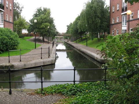
Rhine–Main–Danube Canal
A canal connecting the North Sea to the Black Sea.
The Rhine–Main–Danube Canal, also known as the Main–Danube Canal, RMD Canal, or Europa Canal, is a waterway in Bavaria, Germany. It links the Main and Danube rivers across the European watershed, running from Bamberg through Nuremberg to Kelheim. This canal creates a navigable route from the North Sea and Atlantic Ocean to the Black Sea, connecting the Rhine delta near Rotterdam, Netherlands, with the Danube Delta in southeastern Romania and southwestern Ukraine (or Constanța via the Danube–Black Sea Canal). Completed in 1992, it stretches 171 kilometers (106 miles).
The idea of connecting the Danube and Rhine basins dates back centuries. In 793, Emperor Charlemagne ordered the Fossa Carolina (Karlsgraben) to link the Swabian Rezat and Altmühl near Treuchtlingen. Later, the Ludwig Canal, named for King Ludwig I of Bavaria, was built between Bamberg and Kelheim from 1836 to 1846. Its narrow channel, many locks, and water shortages made it uneconomical, especially as railways expanded in southern Germany. It was abandoned in 1950 after damage from World War II bombing was left unrepaired.
In 1917, Bavaria’s Landtag approved a major shipping route "between Aschaffenburg and Passau" for 1,200-ton Rhine ships. On 13 June 1921, Bavaria and the German Reich agreed to build the "Main-Donau-Wasserstraße," which required a new channel. The Rhein-Main-Donau AG (RMD-AG) was founded on 30 December 1921 to manage the project, funded by controlling water resources of the Main, Danube, Lech, Altmühl, and Regnitz.
First concrete plans emerged in 1938 for the Mindorfer Linie south of Nuremberg, with preparatory work starting in 1939 at Thalmässing. This route was abandoned after the war. By 1962, the Main was expanded to Bamberg. The Duisburger Vertrag, signed on 16 September 1966, secured financing between Bavaria and the Federal Republic. The final section, between Nuremberg and Kelheim, sparked political controversy in the 1970s and 1980s, especially the 34-kilometer stretch through the Altmühl valley. The canal was completed on 25 September 1992, with about 2.3 billion euros invested from 1960 to 1992, nearly 20% for environmental protection.
The route follows the Regnitz valley from Bamberg to Fürth, then the Rednitz valley to beyond Roth. It crosses the Franconian Jura and joins the Altmühl near Dietfurt, following the Altmühl valley to Kelheim on the Danube.
About 60 kilometers of the Ludwig Canal remain in good condition between Nuremberg and Berching. Some locks still work, and part of the towpath is a cycle track. The old canal nears the new one at Pollanten, and they run parallel downstream, meeting 5 kilometers south of Berching.
The canal’s cross-section is typically trapezoidal: 31 meters wide at the bottom, 55 meters at the water surface, 4 meters deep, with a 1:3 side grade. It is Waterway Class Vb, allowing vessels up to 190 meters long and 11.45 meters wide. The Bamberg lock has a depth of 2.70 meters. Rectangular sections are usually 43 meters wide. The canal is 171 kilometers long, with a summit elevation of 406 meters above sea level between the Hilpoltstein and Bachhausen locks—the highest point reached by commercial watercraft from the sea. The north ramp drops 175 meters from Bamberg to the crest via 11 locks. The south ramp drops 68 meters total: 51 meters from the crest to Dietfurt through three locks, plus 17 meters along the Altmühl with two more locks. The Danube end is 107.3 meters above the Main end.
There are 16 locks with lifting heights up to 25 meters, managed from four remote control centers (Neuses since 2007, Kriegenbrunn, Hilpoltstein, and Dietfurt from early 2007). These centers have one worker on night shift and two on day shift. Locks were modernized from 2001 to 2007, replacing relay technology with programmable logic controllers, costing about $1.3 million per lock. The summit pound is maintained by pumping water from lower canal stretches, with some water drained.
- location
- Bavaria, Germany
- type
- Canal
- number_of_locks
- 16
Lore & Background
The Rhine–Main–Danube Canal (German: Rhein-Main-Donau-Kanal; also called Main–Danube Canal, RMD Canal or Europa Canal) is a canal in Bavaria, Germany. Connecting the Main and the Danube rivers across the European watershed, it runs from Bamberg via Nuremberg to Kelheim. The canal connects the North Sea and Atlantic Ocean to the Black Sea, providing a navigable artery between the Rhine delta and the Danube Delta. Projects for connecting the Danube and Rhine basins by canal have a long history. The last section, between Nuremberg and Kelheim, became politically controversial in the 1970s and 1980s, mainly because of the 34-kilometre section through the Altmühl valley. The canal's route follows the Regnitz valley from Bamberg to Fürth, then the Rednitz valley to beyond Roth, crosses the Franconian Jura, and joins the Altmühl near Dietfurt, continuing to Kelheim. The canal has 16 locks, with lifting heights up to 25 meters, managed from four remote control centres.
Reader's Guide
The Rhine–Main–Danube Canal is significant as a major European waterway that connects the North Sea and Atlantic Ocean to the Black Sea, enabling navigation from Rotterdam to the Danube Delta. Its legacy includes ongoing controversy over environmental impact and economic viability. The canal also supports tourism, and remnants of the Ludwig Canal still exist, with some locks functioning and a cycle track on the towpath. The canal's construction included extensive habitat compensation, reflecting modern environmental concerns.
Did You Know?
- The canal has 16 locks, with a maximum lift height of 24.67 meters at the Hilpoltstein lock.
- Almost 20 percent of the construction cost went for environmental protection projects.
A Thousand-Year Dream of Connecting Two Seas
That medieval effort was the first in a long line of attempts to bridge the European watershed. The next major chapter came in the mid-nineteenth century, when the Ludwig Canal was built between Bamberg and Kelheim under King Ludwig I of Bavaria. Yet its narrow channel, numerous locks, and chronic water shortages at the summit quickly rendered it uneconomical, especially as railways spread across southern Germany.
Three Decades of Construction and Controversy
Yet the war interrupted those early efforts, and the Mindorfer route was ultimately discarded. The last stretch, running from Nuremberg to Kelheim, proved the most contentious. A 34-kilometre segment threading through the Altmühl valley sparked intense political debate throughout the 1970s and 1980s, as environmental concerns clashed with economic arguments for a continuous waterway.
Engineering at the Summit
The canal's cross-section is predominantly trapezoidal, measuring 31 metres across the bottom and 55 metres at the water surface, with a depth of four metres and a side slope of one to three. This makes it the highest point on Earth currently reached by commercial watercraft originating from the sea. To sustain the summit pound, water is pumped upward from lower stretches and supplemented by local natural sources; when those fall short, a pumped-storage reservoir called the Dürrlohsee, positioned even higher than the summit pound, provides the additional volume needed.
Locks, Water Conservation, and the Old Canal's Ghost
Sixteen locks line the canal's route, with individual lifting heights reaching up to 25 metres. Their operation is coordinated from four remote control centres—Neuses, Kriegenbrunn, Hilpoltstein, and Dietfurt—each staffed by two workers during the day and one at night. Thirteen of the sixteen locks incorporate water-saving technology: during the down cycle, the top and then middle thirds of the chamber water are piped into side tanks, and those tanks refill the chamber on the up cycle, conserving the fresh water that would otherwise be lost. Meanwhile, a legacy of the older Ludwig Canal persists in the landscape. Approximately 60 kilometres of that nineteenth-century waterway still survive in good condition between Nuremberg and Berching, with some locks still operational and sections of the towpath converted into a cycle track. At Pollanten the old and new canals run close together, flowing in parallel for several kilometres before converging roughly five kilometres south of Berching.
Frequently Asked Questions
What does the Rhine–Main–Danube Canal connect?
The canal creates a navigable route between the North Sea and the Black Sea, effectively joining the Rhine delta to the Danube Delta. This makes it a key artery for European inland shipping.
Why is the Rhine–Main–Danube Canal important?
It provides the only continuous inland waterway linking the Atlantic Ocean basin to the Black Sea. This makes it a critical piece of European trade infrastructure, connecting major river systems across the continent.
More in Canals And Waterways 1-24
Spotted an error? Know more?
This is a living reference — every entry is fact-audited, and reader corrections feed straight into our audit queue. Suggest an edit · See this site's audit record